INNOVATION
Innovating to find better ways to manage trees
Where new technology offers benefits to our clients, The Tree Consultancy Company is quick to adopt innovation – often before any of our peers in New Zealand. This means we have more experience using the latest equipment and systems than any other arboricultural consultants in the country and are able to provide reliable, cost-efficient services.
The Tree Consultancy Company was the first arboriculture company in New Zealand to use GPR for root detection and LIDAR to detect road conflicts. The company is undertaking ongoing research to find innovative ways to minimise costs and increase efficiencies for clients.
Our team has even designed and developed a robot, ALISS, that takes high precision measurements to assist with an ongoing research project. We also design and use customised data collection apps to meet individual project requirements, and have full embedded atmospheric carbon sequestration rates of urban trees to prescribe replanting.
Lidar (Light Detection and Ranging)
Lidar uses laser light directed at targets to measure distances. Vehicle-mounted lidar and high resolution 360 camera footage make it quick and easy to survey tree and street furniture that encroaches into the road corridor.
When The Tree Consultancy Company used Lidar technology in 2017 to survey the canopy of trees that are in the road corridor of new double decker bus routes for Auckland Transport, we were the first arborists in New Zealand to employ Lidar. The technology enables us to deliver the project
- quickly (data collection of 100km can take a matter of hours)
- safely (no risk to personal surveying trees in the road corridor), and
- cost effectively (40% cheaper than conventional methods).
Aerial images
The crucial aspects of a tree might not be readily visible from ground level, so The Tree Consultancy Company uses drones to provide elevated or aerial views of individual trees or stands of trees. This not only enables us to form a better understanding of spatial relationships between trees, but also allows us to zoom in on elements of particular interest, e.g. areas of potential failure.
Ground Penetrating Radar (GPR)
Ground penetrating radar is in wide use to locate underground utility services such as pipes and cables. In 2014, The Tree Consultancy Company became the first arboricultural company in New Zealand to use GPR to map the rooting profile of trees.
This allows us to provide guidance for development designs without disturbing the soil. There is no need to excavate the ground, where in some instances a separate consent would be required, resulting in extra cost and project delays. Roots can even be traced through road surfaces, avoiding the need for digging and reinstatement.
The integrity and health of the tree is not compromised.
ALISS
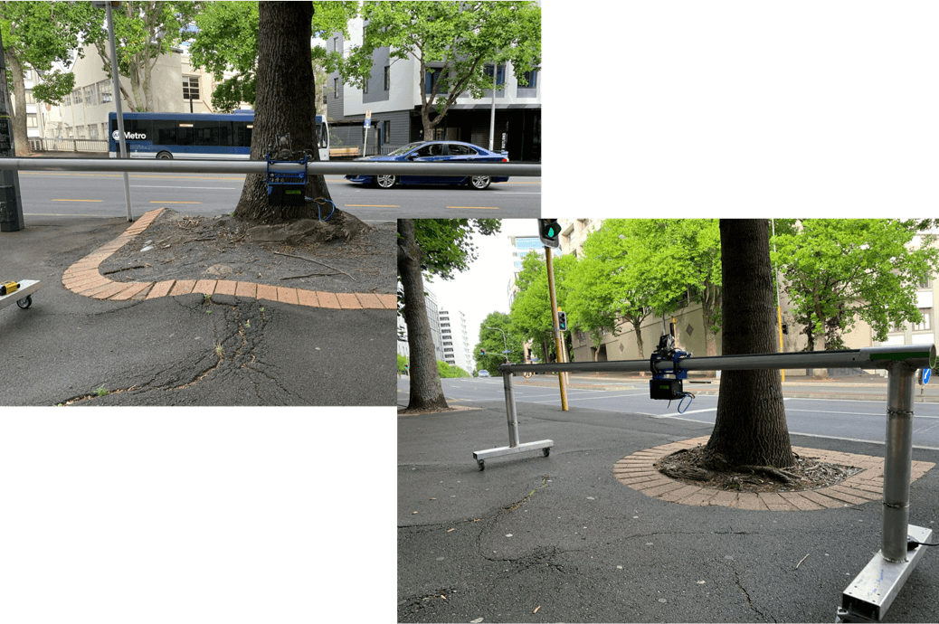
ALISS is an Automated Longitudinal Infrastructure Surface Scanner, and she’s helping us get to the ‘root cause’ of footpath deformation caused by trees. With her help, and a little data analysis, we are aiming to find out which combinations of trees and footpaths work and which ones don’t, so that we can better inform future tree planting decisions to prolong footpath surface integrity.

To find out more about the possibilities innovative technology may hold for your tree management, feel free to contact us.
